
Practical RV Guide · 12 min read
RV GPS vs Phone Navigation Apps
Compare RV-specific GPS units and apps with standard phone maps on low bridges, weight limits, offline maps, cost and what to enter in your rig profile.

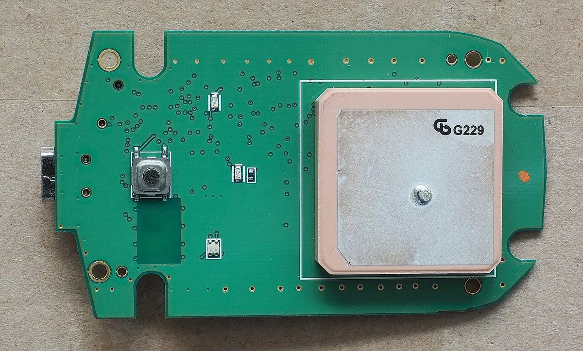
Use an RV-specific GPS (a dedicated unit, or an RV routing app with your rig profile) whenever you tow or drive something tall, heavy or long, because it routes around low bridges, weight limits and tight turns that a standard car map does not know about. A regular phone map app is fine for the last mile to a gas station or a restaurant and for checking traffic, but it routes as if you were in a sedan. The best setup for most RVers is both: an RV-aware primary navigator and a phone app as a backup, with maps downloaded for offline use before you leave.
The stakes are not trivial. A 13-foot-6-inch rig that meets a 11-foot bridge does not slow down gracefully. Below is what separates the two kinds of navigation, how to build a rig profile, how offline maps and signal affect the choice, what each option costs, and the checks that no GPS can do for you.
What a standard phone map does and does not know
Mainstream phone navigation apps are built for cars. They optimize for the fastest or shortest route, adjust for live traffic and suggest turns well. Most do not ask for your vehicle's height, weight or length, and they do not know that you carry propane. In practice, that means:
- Low clearances. The route may pass under a bridge or through a tunnel that is shorter than your rig.
- Weight limits. The route may cross a bridge or road posted for lighter vehicles.
- Tight turns and steep grades. A route may include switchbacks, narrow streets or steep descents that are fine in a car and risky with a long trailer.
- Propane restrictions. Some tunnels and routes restrict vehicles carrying propane.
- Fuel stops and parking. A highlighted gas station may have a low canopy or no room to turn a long rig around.
Some phone apps offer a truck or RV mode in certain regions, and third-party RV apps run on phones and tablets. Those are in the RV-aware category, not the standard category. The distinction that matters is whether the app asks for your rig's dimensions and routes with them.
What an RV-aware navigator does differently
An RV GPS, whether a dedicated device or an RV routing app, builds its route from a profile of your rig:
| Profile field | Why it matters |
|---|---|
| Height | Avoids low bridges, tunnels and underpasses |
| Weight | Avoids weight-restricted bridges and roads |
| Length (with towed vehicle) | Avoids tight turns and narrow streets |
| Width | Avoids narrow roads and lanes |
| Axles | Some roads have axle-based limits |
| Propane | Avoids restricted tunnels |
| Towing | Considers trailer-specific restrictions |
You enter the numbers once, and the device routes accordingly. Many also warn about steep grades, sharp curves and upcoming low-clearance signs. The best ones show RV parks, fuel stops with RV access and rest areas.
Importantly, no navigation product has perfect data. Clearance and restriction databases are built from government data, user reports and map sources, and they can be missing or out of date. A new bridge, a recently lowered road or a temporary restriction may not appear. An RV-aware route is much safer than a car route, but it does not replace reading signs and watching the road.
Side-by-side comparison
| Factor | RV GPS (dedicated or RV app) | Standard phone map app |
|---|---|---|
| Rig profile (height, weight, length) | Yes | Usually no |
| Avoids low bridges and tunnels | Yes, with limits | No |
| Weight and propane restrictions | Often | No |
| Live traffic | Varies, often via phone or subscription | Excellent |
| Offline maps | Built in for dedicated units, downloadable for apps | Possible, must be downloaded in advance |
| Screen size | Larger on dedicated units | Phone-sized, mount-dependent |
| Works without cell signal | Dedicated units yes | Only with downloaded maps |
| Battery and heat | Powered by the vehicle | Drains the phone battery, may overheat in sun |
| Cost | Hardware cost, sometimes subscription | Free, some paid features |
| Distractions | Dedicated function | Calls, texts and notifications |
| Updates | Map updates sometimes cost extra | Continuous |
Weigh the two columns against the kind of trip you take. A weekend trip in a small trailer on interstate highways has a low chance of trouble. A 40-foot motorhome traveling through mountain towns and old cities has a high one.
Offline maps and coverage
Cell coverage is thin in many scenic places. A phone navigator that depends on data fails exactly where you need it most. Mitigate this by downloading offline maps for the regions you will cross, and update them before every trip. Some features, such as searching for places, live traffic and sometimes routing, may not work without a connection, so test your app in airplane mode at home before relying on it. Dedicated GPS units store maps on the device, so they work without a signal, and the satellite signal itself does not need cell service. If your phone is your GPS, consider its battery and mount. A phone left in a sunny windshield mount can overheat and shut down.
If staying connected matters beyond navigation, the guide to how cell signal boosters work in an RV covers one way to improve your signal, and how a campground WiFi extender works covers another. Neither replaces offline maps for a canyon with no towers.
Android Auto and Apple CarPlay
Many RVs and tow vehicles have infotainment screens that support Android Auto or Apple CarPlay. That lets you run a navigation app on the dash display, which is easier to see than a phone. Some RV navigation apps work with these systems, and some dedicated units connect to the phone for traffic and updates. If you want an RV navigator that appears on your car's screen, look at the best RV GPS app for Android Auto and the best RV GPS for Apple CarPlay. Check compatibility with your phone and vehicle before buying, since support varies.
Cost and subscriptions
RV navigation costs range from free to a few hundred dollars. A dedicated unit is a one-time purchase, sometimes with free lifetime map updates, and sometimes with paid updates. RV routing apps typically charge an annual or monthly subscription, though some have a one-time fee, and offer free tiers with limited features. Standard phone apps are free.
- No-subscription options. If you do not want a recurring cost, see the best RV GPS without subscription.
- Free apps. The best free RV GPS apps show what you get without paying, and the best offline RV GPS apps emphasize apps that work without cell service.
- Dedicated units. The broader best RV GPS list is a good start, and the best RV GPS for fifth wheels concentrates on large towables. If you want a unit that also works with a backup camera, check the best RV GPS with a backup camera.
Consider the real cost of a wrong turn. Even a modest dedicated unit costs far less than the repair bill for a ripped roof air conditioner.
How to build an accurate rig profile
The routing is only as good as your numbers. Measure and record:
- Height. Measure from the ground to the highest point, including the air conditioner, satellite dish, antennas and any roof cargo. Measure with the tires inflated and the vehicle loaded. Add a few inches of margin.
- Weight. Use the gross vehicle weight rating or a recent scale weight. Enter the actual weight of a loaded rig.
- Length. Include the tow vehicle, the trailer or the toad. Enter the overall length from the front bumper to the rear.
- Width. Measure with mirrors extended if they matter.
- Propane. Indicate if you carry propane.
- Towing and axles. Enter these if the app asks.
Update the profile when you change anything, such as adding a roof box or a new air conditioner. A common mistake is entering the manufacturer's listed height, which may not include later additions. Write the height on a card and stick it on the dash where you can see it, so that you have a mental check against any sign.
Habits that matter more than the device
No navigation product replaces good practice.
- Read the signs. A posted clearance sign overrules the GPS.
- Plan the route in advance on a large screen, and review the whole route, not just the next turn.
- Check satellite or street view for the first and last miles, especially for campgrounds, which often have narrow entrances.
- Call the campground and ask about the best route for your rig length.
- Avoid following routes blindly through small towns, old neighborhoods or parkways, which often forbid trucks and RVs and have low bridges.
- Know your fuel stop plan. Look up truck stops and large stations, and avoid ones with low canopies.
- Have a plan to turn around. On a road with no shoulder and a low bridge ahead, you may need to find a safe place to turn.
- Keep the phone as a backup. Use it to check traffic and alternatives.
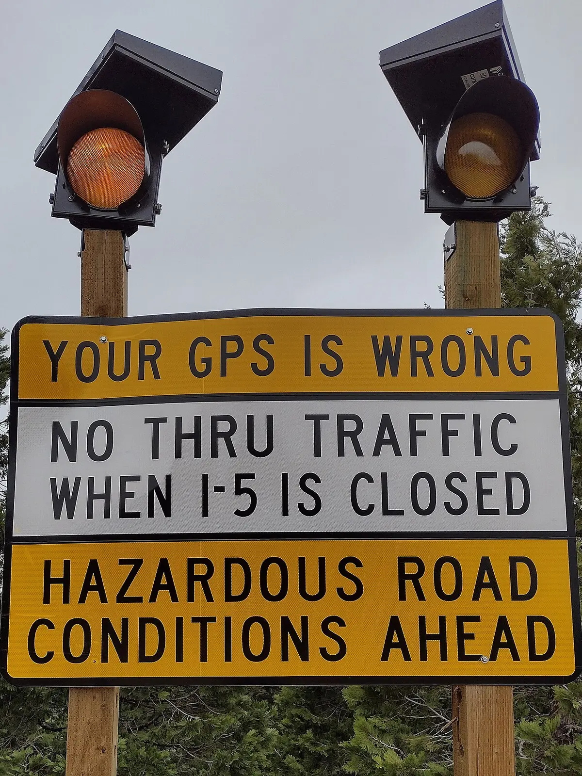
Two scenarios
A 30-foot travel trailer on interstates between campgrounds. The route is mostly highways, and the trip includes a few last-mile roads. A phone app with offline maps and a quick check of the final approach is usually enough. A rig profile in an RV app adds a margin for the few unusual segments, and the cost is small.
A 38-foot Class A motorhome towing a car, traveling through the Northeast. Older bridges, parkways with low clearance, narrow historic streets and propane restrictions in some tunnels make a standard map risky. A dedicated RV GPS or a robust RV app with a correct rig profile is a sound investment, and the phone provides traffic and a second opinion.
Both scenarios benefit from planning. For help with the broader trip, a day-by-day plan with fuel, rest and campground stops is a good starting point.
A pre-trip routing workflow that catches most problems
Whichever device you choose, a short routine before each travel day removes most of the risk. It takes about fifteen minutes.
- Enter the destination and let the device propose a route. Do not start driving yet.
- Zoom out and read the whole route. Look for towns with narrow main streets, parkways, tunnels, mountain passes and roads with route numbers you do not recognize.
- Compare with a second source. Open the same trip in a standard phone map and see where the two routes differ. A difference often marks a restriction the RV-aware route is avoiding, or one the car route ignores. Understanding why saves surprises.
- Check the last mile in satellite view. Campgrounds, parks and stores often sit on small roads. Look for overhanging trees, tight turns, one-way loops and gates.
- Check fuel and rest stops. Pick stations along the route that suit your length and height, and note them in advance. Large truck stops are usually the safest choice.
- Check weather and wind. High wind affects tall rigs on exposed roads, and snow or ice changes mountain passes.
- Save the route offline and confirm that the maps for the whole corridor are downloaded.
- Share the plan. Tell a friend or family member where you plan to stop.
On the road, make it a habit for the passenger, if there is one, to watch the signs while the driver watches the road. A second set of eyes catches low-clearance signs, closures and changes that the screen has not caught up with.
Testing a navigator before you trust it
Treat any new navigation setup as a piece of safety gear and test it close to home. Enter a route you already know well, including one bridge you know is low and one road you know is restricted for trucks, and see whether the device handles them correctly. Change the profile height to something absurdly low and confirm that it refuses to route under the bridge. Put the phone in airplane mode and check that the downloaded maps still route and speak turn instructions. Drive a short loop with a trailer attached if you can, and learn how the device announces lane changes, so that the voice cues are familiar before you meet a busy interchange. Finally, check how it handles a missed turn: a good RV navigator recalculates with your profile, while a poor one may suddenly offer a car shortcut. Ten minutes of testing tells you more than any review.
Mounting, power and screen considerations
A navigator is only useful if you can see it and it stays powered. Mount a dedicated unit or a phone at eye level, low on the windshield or on the dash, where it does not block your view and complies with local laws about windshield mounts. Use a secure mount, since a phone sliding off a mount on a rough road is a hazard. Keep the device out of direct sun if you can, and run the air conditioning vents toward it in hot weather, because phones may throttle or shut down when overheated. Use a reliable charging cable and a 12 V adapter rated for the phone's fast-charging needs, and carry a spare cable. For tablets, which many RVers prefer for their size, a sturdy mount and a power source are essential.
Consider the screen's visibility in glare and the size of text. On a bright day, a matte screen is easier to read, and a large display helps you see lane guidance for complex interchanges. Voice guidance should be loud enough to hear over the engine and road noise, and many RVers prefer a dedicated unit with a clear speaker.
When you arrive: setting up camp
Navigation ends at the gate, but a good arrival matters too. Once you have parked and leveled, you can think about comfort. A weather-resistant mat or rug under the awning keeps dirt out of the rig, and the guide to choosing an RV outdoor rug covers sizing and materials. Staying connected for the evening, whether by cell or WiFi, is the other common arrival task, and the explanations in how cell signal boosters work in an RV and how a campground WiFi extender works help you decide what to add.
Common mistakes to avoid
- Trusting a car map with an RV. It does not know your height.
- Entering the wrong height. Include everything on the roof.
- Skipping the offline download. Signal drops where you need it.
- Ignoring road signs. A sign overrules the screen.
- Using a phone in direct sun on a hot dash. It overheats.
- Following the route into a campground without checking the entrance. Look at the approach.
- Assuming a subscription app updates itself. Check that maps are current.
- Relying on a single device. Have a backup.
Frequently asked questions
Do I really need an RV GPS, or is Google Maps enough?
For small, low rigs on major roads, a phone map may be enough. For tall, heavy or long rigs, an RV-aware navigator is much safer, since it uses your dimensions to avoid low clearances and weight limits. Many RVers use both.
Can a phone app avoid low bridges?
Only if it has an RV or truck mode that uses your height and its data covers the area. Standard modes of mainstream apps route for cars. Check the app's documentation, and verify with signs.
Is a dedicated RV GPS worth the money?
If you travel often, tow a large rig or pass through areas with low bridges and weak cell coverage, yes. The unit works without a signal, has a large screen and is dedicated to the task. For occasional trips, an RV app may be enough.
Do RV GPS units work without cell service?
Dedicated units use satellite signals and stored maps, so they work without cell service. Apps need offline maps downloaded in advance, and some features, such as searching and live traffic, still need a connection.
How accurate are the low-clearance warnings?
They are helpful, but not perfect. Data can be missing, outdated or inconsistent, especially for new or temporary restrictions. Treat the warnings as a safety net, not a guarantee, and always obey posted signs.
Should I use my phone's navigation as a backup?
Yes. It helps with traffic, alternatives and a second opinion. Download offline maps, mount the phone securely out of direct sun and keep it charged.
Sources & further reading
- RV.com: RV GPS vs. smartphone maps, which one works best
- RV Travel: Don't trust GPS
- Roadtrippers: RV GPS, plan safer routes and better stops
Image credits
- "Gps-receiver-GT750-top" by Kreuzschnabel, CC BY-SA 3.0, via Wikimedia Commons.
- "Your GPS Is Wrong" by BBQboffin, CC BY-SA 4.0, via Wikimedia Commons.


Ready to buy?
Compare the gear: Camping & Travel
6 Best RV Gps App For Android Auto in 2026
Android Auto and RV navigation compared: one display that lists Android Auto, plus standalone RV and truck GPS units for when you want routing without a phone.
6 Best RV Gps For Apple Carplay in 2026
Apple CarPlay displays for RV navigation compared with a standalone GPS, including motorcycle CarPlay screens, with notes on what listings do and do not claim.
5 Best RV Gps For Fifth Wheel in 2026
Compare Garmin and budget RV GPS units for fifth wheel owners, covering screen size, custom size and weight routing, campground data and map updates.
5 Best RV Gps With Backup Camera in 2026
Compare RV GPS navigators and camera-equipped monitors for rear, side and blind-spot views, so you can match screen, routing and recording to your rig.
4 Best RV Gps Without Subscription in 2026
Find RV GPS navigators with free map updates and no subscription, from Garmin RV bundles to budget 7 and 9 inch units, with routing and update details.
6 Best Offline RV Gps App in 2026
There is no app in this guide: it compares offline GPS navigators with preloaded maps, plus one GPS tracker, so RVers can navigate without cell service.
6 Best RV Gps in 2026
Compare two Garmin RV navigators and four budget truck and RV GPS units by screen size, RV profiles, map updates and parks directories.
6 Best Free RV Gps App in 2026
Free RV navigation apps cover basic trips, but these six dedicated GPS units add vehicle-size routing and no phone data, with free map update listings.
Keep reading